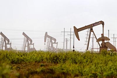
DRILLING
County Operator Lease/Well Field Survey Type Depth Location
Freestone Comstock Oil & Gas LLC. Olajuwon PP/1H Dowdy Ranch Telano, A. gas 30000 6.1 miles northwest of Oakwood
Freestone Southwest Operating Inc. Tyler Keyes/2 Wildcat Wheeler, H. oil or gas 5500 13.2 miles southwest of Palestine
Houston Maximus Operating LTD. Red Town/1 Navarro Crossing De La Garza, R. oil or gas 8000 7.85 miles northwest of Crockett
Nacogdoches Sonerra Resources Corporation Moon Pie/60 Nacogdoches Mora, J.M. oil or gas 500 15 miles southeast of Nacogdoches
Panola TGNR East Texas LLC. Kyle Hancock/1UH Carthage (Haynesville Shale) Anderson, W. gas 13000 4 miles southeast of Carthage
Panola TGNR East Texas II LLC. Westmoreland HV Unit D/4H Carthage (Haynesville Shale) Tuttle, D. Jr. gas 13000 3.5 miles northwest of DeBerry
Panola TGNR East Texas II LLC. Westmoreland HV Unit E/5H Carthage (Haynesville Shale) Tuttle, D. Jr. gas 13000 3.5 miles northwest of DeBerry
Panola TGNR East Texas II LLC. T.A. Greer HV Unit B/2H Carthage (Haynesville Shale) Straw, L. 13000 2.5 miles north of DeBerry
Robertson Hilcorp Energy Company Moss Gas Unit/1 Bald Prairie Nixon, G.A. gas 14500 4.5 miles southwest of Hearne
Smith Strand Energy LC. Hopper/1 Loretta Rose Adams, W.H. oil 9900 9.8 miles northwest of Tyler
Wood Strand Energy LC. Mulcahy/1 Shirley-Barbara Clark, W.J. oil 9900 7.3 miles northwest of Hawkins
COMPLETIONS
County Operator Lease/Well Field Depth Flow Rate (42 Hrs.) Choke Size Location
Anderson McGowan Working Partners Inc. N.N. Willis D/25 Cayuga 4200 N/A N/A 1 mile west of Cayuga
Harrison King Operating Corporation Brown, L.D./6A Gooch 8500 N/A N/A 10.1 miles northwest of Marshall
Harrison Rockcliff Energy Operating LLC. T.P. Smith HV Unit E/5H Carthage (Haynesville Shale) 10868 N/A N/A 3.5 miles southwest of Waskom
Harrison RFE Operating LLC. Tally-Dega 1/1H Woodlawn, SW. 10305 5775 28/64 7 miles west of Marshall
Harrison Sabine Oil & Gas Corporation Floyd Unit/1H Carthage (Haynesville Shale) 11042 N/A N/A 7.5 miles southeast of Marshall
Harrison Sabine Oil & Gas Corporation Floyd-Hope B/2H Carthage (Haynesville Shale) 11176 N/A N/A 7.5 miles southeast of Marshall
Harrison Sabine Oil & Gas Corporation Floyd-Hope C/3H Carthage (Haynesville Shale) 11030 N/A N/A 7.5 miles southeast of Marshall
Harrison Sabine Oil & Gas Corporation Furrh-Mims/3H Carthage (Haynesville Shale) 11074 N/A N/A 14.5 southeast of Marshall
Harrison Valley Plains LLC. Walker/1 Gooch-Garrett 5469 N/A N/A 6 miles east of Harleton
Harrison Brookston Energy Inc. Trammell/2 Waskom 9800 N/A N/A 3 miles west of Jonesville
Henderson Highmark Energy Operating LLC. Miller-Hurt No. 2/3 Fairway 10140 N/A N/A 2.3 miles northeast of Poynor
Houston Kodiak Oil & Gas Inc. Huffman, L.W./10 Trinity 2235 N/A N/A 7 miles southwest of Lovelady
Leon Roberts & Hammack Inc. R.A. Porter/3 Red Oak 5992 43 14/64 5 miles southeast of Buffalo
Nacogdoches Aethon Energy Operating LLC. Silver Hammer/1H Carthage (Haynesville Shale) 13718 N/A N/A 17 miles east of Nacogdoches
Navarro KO Operating LLC. Pugh, L.W./2SW Powell 3484 N/A N/A 6 miles southeast of Corsicana
Panola Sabine Oil & Gas Corporation Sawmill LW A/1H Carthage (Haynesville Shale) 11042 19796 28/64 14 miles northeast of Carthage
Panola Sabine Oil & Gas Corporation Sawmill LW C/3H Carthage (Haynesville Shale) 11070 19049 28/64 3.8 miles east of Hallsville
Rusk Basa Resources Inc. South Kilgore Unit/79I East Texas 3620 N/A N/A 2 miles south of Kilgore
Smith Vess Oil Corporation Sand Flat Unit/31 Sand Flat 7370 N/A N/A 10 miles north of Tyler
Smith Maximus Operating LTD. Hopper, Clarence Estate/1 Hopper 12270 N/A N/A 9 miles northwest of Tyler
Upshur Sabine Oil & Gas Corporation Wertz-Collie A/1HR Gilmer 11035 N/A N/A 9.75 miles southwest of Gilmer

